Main Menu
AORC Libraries
Maps of the Ottoman Empire
Dublin Core
Title
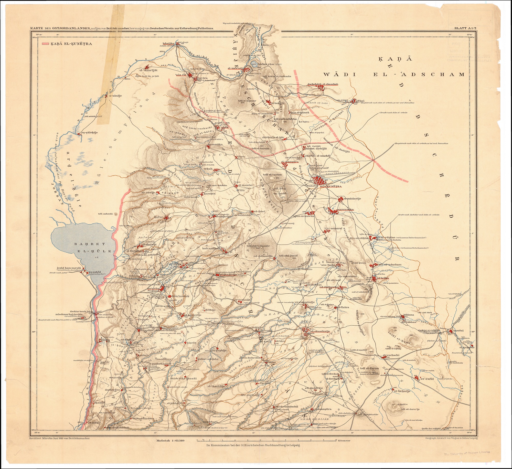
Karte des Ostjordanlandes : Blatt A1/2
Subject
Israel
Jordan
Description
Map of the lands of Jordan (centered on modern day northern Israel). Compiled at the Intelligence Division War Office by Major F.R. Maunsell, R.A. derived from multiple expeditions 1839-1906.
Scale: 1:63,360
Creator
Schumacher, G.
Publisher
Leipzig : Deutschen Verein zur Erforschung Palaestinas
Date
[1913?]-1921
Contributor
W. F. Albright Institute of Archaeological Research (AIAR)
Center for Ancient Middle Eastern Landscapes (CAMEL), University of Chicago
Rights
Public Domain
Relation
Geo-referenced .tiff version available. Contact dlir@caorc.org for more information.
Format
Map
113.86 × 104.32 inch
application/pdf
Language
French
Type
Image
Identifier
1015297_GIPR_Karte_des_Ostjordanlandes_Blatt_A1-2_1913
Coverage
Israel
Collection
Dublin Core XML
Citation
Schumacher, G. , "Karte des Ostjordanlandes : Blatt A1/2," online in Digital Library for International Research Archive, Item #15889, http://dlir.org/archive/items/show/15889 (accessed July 26, 2026).
Download Files
Geolocation
Share this Item


