Main Menu
AORC Libraries
Maps of the Ottoman Empire
Dublin Core
Title
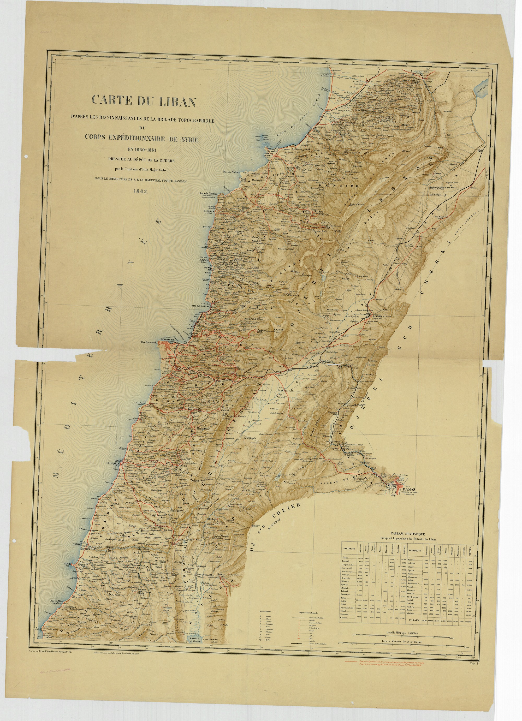
Carte du Liban d'apres les reconaissances de la brigade topographique du Corps Expeditionnaire de Syrie en 1860-61
Subject
Lebanon
Description
Map of Lebanon from an expedition of Syria 1860-1861.
Scale: 1:200,000
Creator
Gelis, Capitaine d'Etat Major
Publisher
Paris : France. Depot de la Guerre
Date
1862, corr. to 1919
Contributor
W. F. Albright Institute of Archaeological Research (AIAR)
Center for Ancient Middle Eastern Landscapes (CAMEL), University of Chicago
Rights
Public Domain
Relation
Geo-referenced .tiff version available. Contact dlir@caorc.org for more information.
Format
Map
26.67 × 36.84 inch
application/pdf
Language
French
Type
Image
Identifier
1010186_CDLB_Carte_du_Liban_en_1862_1919
Coverage
Lebanon
Collection
Dublin Core XML
Citation
Gelis, Capitaine d'Etat Major , "Carte du Liban d'apres les reconaissances de la brigade topographique du Corps Expeditionnaire de Syrie en 1860-61 ," online in Digital Library for International Research Archive, Item #15888, http://dlir.org/archive/items/show/15888 (accessed July 26, 2026).