Main Menu
AORC Libraries
Maps of the Ottoman Empire
Dublin Core
Title
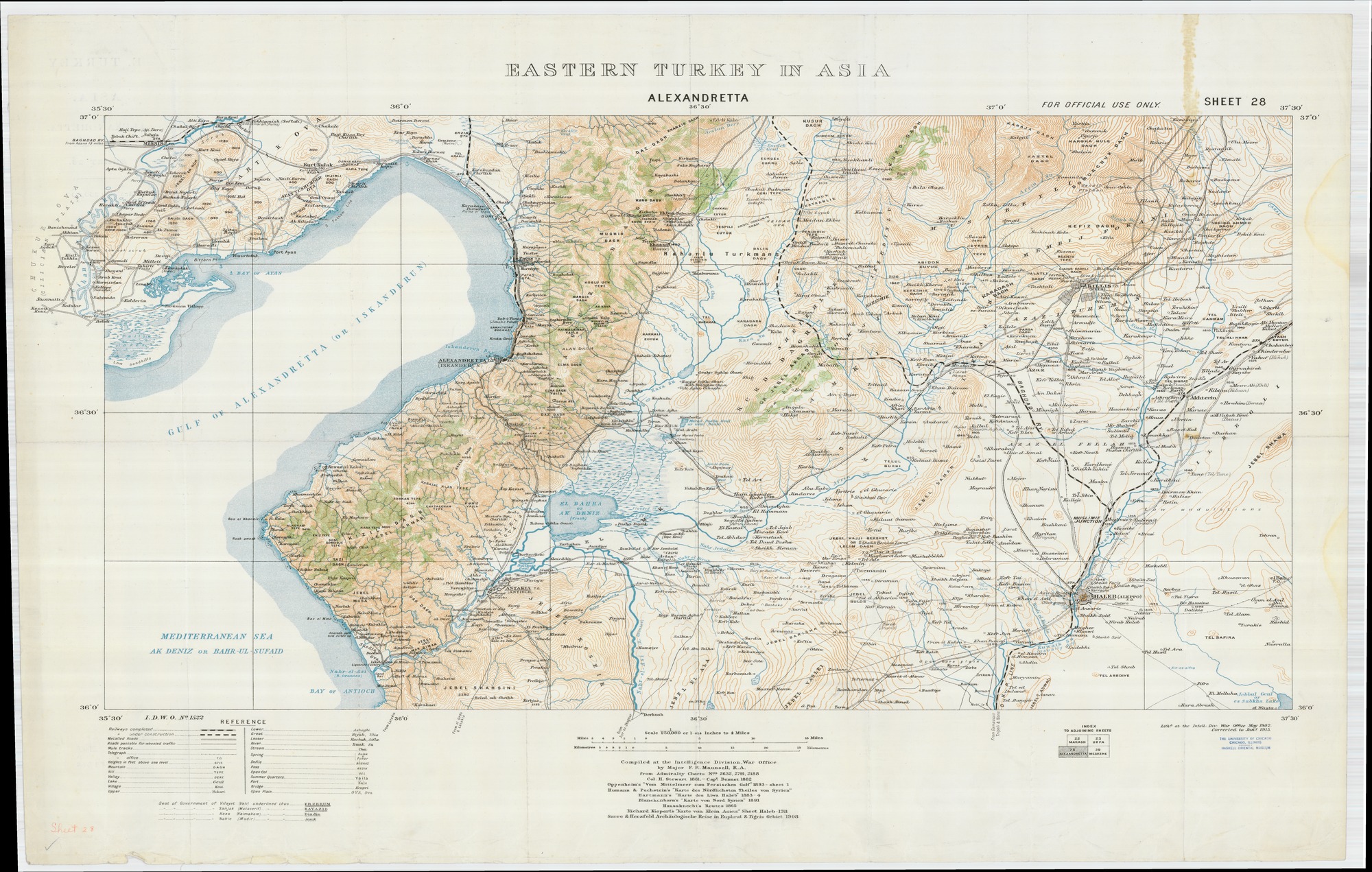
Eastern Turkey in Asia : Sheet 28 - Alexandretta
Subject
Turkey
Syria
Description
Map of Eastern Turkey (centered on modern day northern Syria in Iskenderun area). Compiled at the Intelligence Division War Office by Major F.R. Maunsell, R.A. derived from multiple expeditions 1839-1906.
Scale: 1:250,000
Creator
Maunsell, F. R.
Publisher
London : British War Office
Date
1915
Contributor
W. F. Albright Institute of Archaeological Research (AIAR)
Center for Ancient Middle Eastern Landscapes (CAMEL), University of Chicago
Rights
Public Domain
Relation
Adjoins Sheet 22 (Marash), Sheet 23 (Urfa), and Sheet 29 (Meskene).
Geo-referenced .tiff version available. Contact dlir@caorc.org for more information.
Format
Map
141.38 × 89.86 inch
application/pdf
Language
English
Type
Image
Identifier
1014470_ETAS_28_Alexandretta_1915
Coverage
Turkey
Collection
Dublin Core XML
Citation
Maunsell, F. R. , "Eastern Turkey in Asia : Sheet 28 - Alexandretta," online in Digital Library for International Research Archive, Item #15899, http://dlir.org/archive/items/show/15899 (accessed July 26, 2026).