Main Menu
AORC Libraries
MEDMAPS
Dublin Core
Title
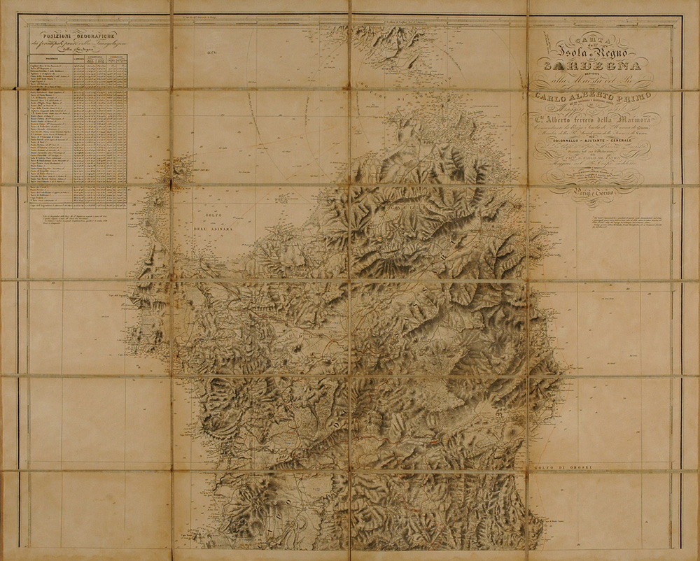
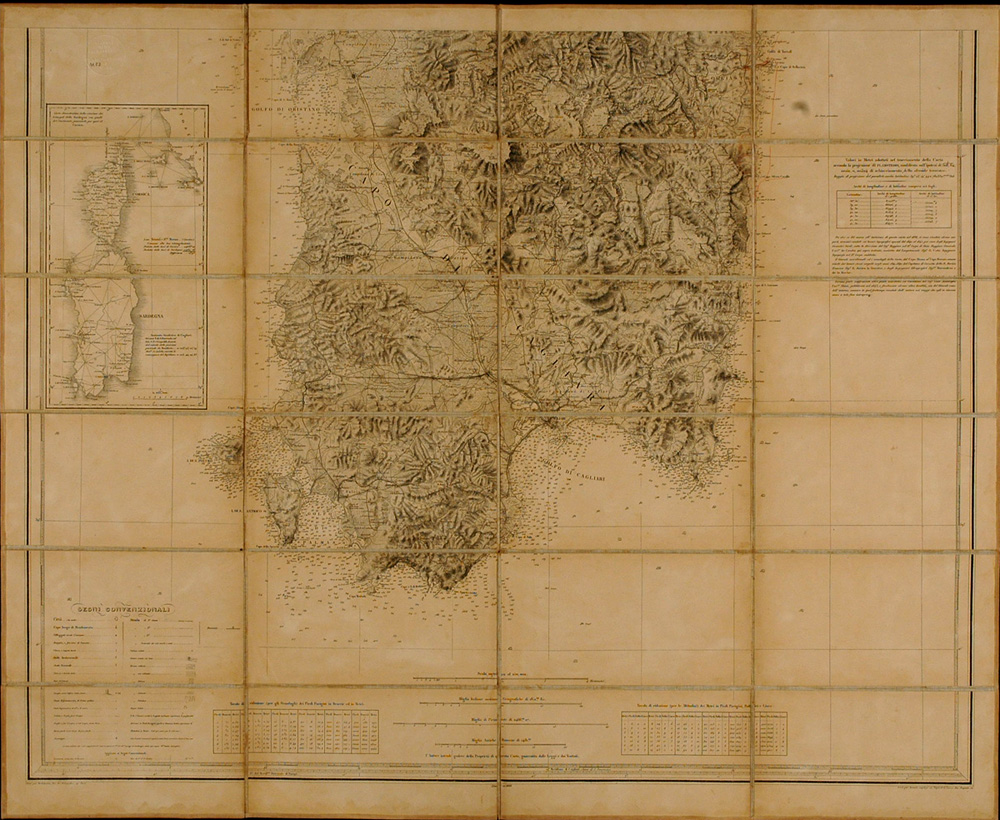
Carta del isol e regno de Sardegna
Description
dedicata alla Maesta del Re Carlo Alberto Primo...
Engraved map by Alberto Ferrero della Marmora and Carlo di Candia.
1 map on 2 sheets ; 133 x 86.5 cm. on sheets 66.5 x 86.5 cm.
Scale 1:250,000.
Engraved by Desbuissons.
With an inset of Corsica and Sardinia on the second sheet.
Della Marmora (1789-1863) was a career officer. He enrolled in the Military School of Fontainebleau in 1806 and joined the French army. Imbued with the ideas of the French Revolution, he took part in many actions, including the Battles of Wagram and of Leipzig. He was taken prisoner at the latter and sent to Russia. After the fall of Napoleon he returned to Italy, to Torino, where he entered the regimental guard with the rank of lieutenant. In February, 1819, he made his first journey to Sardinia to study the ornithology of the island. Suspected of taking part in the Piedmontese movement, della Marmora was removed from his post in October 1821 and exiled to Sardinia. He spent three years on the island until his reinstatement in March, 1824. During this period he travelled all over the island and studied it in all its aspects. The fruit of this first visit was his Voyage en Sardaigne, Paris, 1826, 1 volume in 2 parts, with an atlas of plates. In 1831 he was posted to Sardinia in a military capacity, and in 1849 he was named commander general of Sardinia.
Della Marmora’s large map of the island, first published in 1845, is the result of 14 years of geodetic and trigonometric studies, with particular attention to geology. In the introduction to the second edition of his Voyage en Sardaigne, Torino and Paris, 1839-1840, he says that the map has taken much longer to construct than he had originally expected, ‘... par suite du désir que j’ai toujours eu de donner à cette carte toute la perfection possible...’. He continued his researches into the island and published a third part of the Voyage, ‘Geologie’ in two volumes in 1857. The ‘Itineraire’, a 2 volume account of his travels on the island, rather than the result of researches, was not published until 1860. The map we exhibit here is a later edition of della Marmora’s original map first published in 1845.
Ferrero della Marmora is a classic example of the soldier-traveller who produced serious historical and cartographical work apart from the demands of his professional career.
Source
This map is a reprint published in 1898. It was first published in connection with Ferrero della Marmora's Voyage en Sardaigne, Paris, Arthus Bertrand, 1839-1857.
Publisher
Rome : Ulderico Bossi, 1898.
Date
1898
Contributor
From the collection at the American Academy in Rome, Top 052.2 Sar B
Collection
Dublin Core XML
Citation
"Carta del isol e regno de Sardegna," online in Digital Library for International Research Archive, Item #7, http://dlir.org/archive/items/show/7 (accessed July 26, 2026).