Main Menu
AORC Libraries
Browse Items in MEDMAPS (16 total)
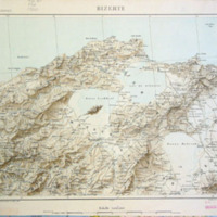
Map of Greece: geographic and altimetric
Description: Two lithographed maps from a set on six sheets by C. Grigouras.
Publisher: Athens: C. Grigouras and C. Papamandellos, 1929.
Contributor: From the collection of the American Research Institute in Turkey (Ankara), M.36.
Collection: MEDMAPS
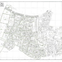
Archaeological zone of Athens
Description: Printed map by Ka[lligas?].
Publisher: Athens, 1936.
Contributor: From the collection of the W. F. Albright Institute of Archaeological Research (Jerusalem), Map…
Collection: MEDMAPS
400_c7577448fc.jpg)
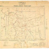
Trans-Jordan track map: Sharq Al-Urdun-kartt Muasalat
Description: Engraved map on 2 sheets.
Publisher: Printed by the Survey of Palestine.
Contributor: From the collection of the American Center of Oriental Research (Amman, Jordan), M.32.
Collection: MEDMAPS
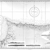
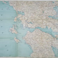
Stazousa Point to Cape Limniti and Stazousa Point to Cape Eloea
Description: Two engraved maps compiled by the Hydrographic Office of the British Admiralty.
Publisher: London: Hydrographic Office, British Admiralty, 1953-1957.
Contributor: From the collection at the American Center of Oriental Research (Amman, Jordan), M.81.
Collection: MEDMAPS

