Main Menu
AORC Libraries
MEDMAPS
Dublin Core
Title
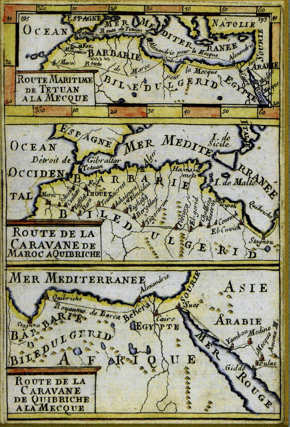
Route Maritime de Tetuan à la Mecque - Route de la Caravan de Maroc à Quibriche - Route de la Caravane de Quibriche à la Mecque
Description
Engraved maps by Alain Manesson Mallet.
3 maps in 1, 15 x 10 cm.
3 maps in 1, 15 x 10 cm.
Alain Manesson Mallet (1630?-1706?) was a French army engineer. He served under the King of Portugal, and on his return to France he was appointed mathematics master at the court of Louis XIV. In 1671 he published Les Travaux de Mars, ou art de la Guerre avec un ample detail de la milice de Turcs, which was translated into German, and in 1702 he produced La Geometrie Pratique. In 1683 he produced his encyclopaedic description of the world, Description de l’ Univers (2nd edition 1686). The success of this work inspired a German edition which appeared in 1684 as Beschreibung des gantzen Welt-Kreises, (2nd edition 1719).
Mallet’s maps are not original but are based on earlier prototypes, such as the work of Marco Boschini and other Italian cartographers. However, the prototypes for these three small maps of the North African coast are so far unidentified. The caravan route from Morocco to Mecca was probably established not long after the Arab conquest of North Africa in the 7th century and must have been well organized by the 17th century. Although the route depicted was used by merchants, the word ‘caravan’ in this context probably refers to the route of the yearly pilgrimage (hadj, hajj) to Mecca that all faithful Moslems are obliged to make at least once. European writers used the word ‘caravan’ for these pilgrim-trains. It was the custom for the pilgrim-caravan to depart for Mecca once a year, on a specific day and month. Because the Moslem calendar is based on the lunary system, the period of the pilgrimage varied from year to year. The North African pilgrim-caravan joined the Egyptian pilgrim-caravan at Cairo. The top map shows the route by sea from Tetuan (40 miles east of Tangier) to Alexandria and then overland via Cairo and Suez to Medina and Mecca. The overland caravan route depicted in the middle and lower map start from Marrakesh, crossed the edge of the Sahara and reached Tripoli in Libya and then Quibriche (Bengazi). The lower map shows the route from Quibriche to Alexandria, Cairo and Suez to Medina and Mecca.
Encyclopaedic descriptions like that of Mallet’s were popular during the late 17th century; others that come to mind are the works of Olfert Dapper and of Jacques Grasset de Saint Sauveur. These books describe the customs, habits and costume of the populations, and the topography and geography of all four corners of the world. The pilgrimage to Mecca would have been a normal subject of discussion in a work of this nature.
Publisher
Published in Afrique Ancienne et Moderne
(Mallet’s Description de l’ Univers, volume 3)
(Mallet’s Description de l’ Univers, volume 3)
Paris: Denys Thierry, 1683.
Date
1683
Contributor
From the collection of the Tangier American Legation Museum (Morocco), M.074
Collection
Dublin Core XML
Citation
"Route Maritime de Tetuan à la Mecque - Route de la Caravan de Maroc à Quibriche - Route de la Caravane de Quibriche à la Mecque," online in Digital Library for International Research Archive, Item #3, http://dlir.org/archive/items/show/3 (accessed July 21, 2026).